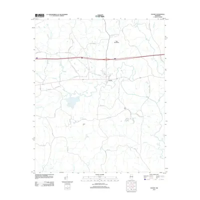
2012 Map of Chunky
USGS Topo · Published 2012About this map
The Chunky River and its numerous tributaries, including Tallahatta Cr and Tonacana Cr, define the drainage patterns of this Newton County landscape. The town of Chunky serves as a local hub, situated where the river bends south and the modern interstate corridor intersects with historic routes like Chunky-Duffee Rd. To the north, the small settlement of New Providence is reached via New Providence Church Rd, illustrating the community's roots in local congregations.
Find a feature on this map
55 named features on this map. Tap any name to fly to it.
Don’t see what you’re looking for? This feature index may not catch every label — zoom into the map to look around manually.
Map Details
Editions of this 2012 Chunky Map
This is the sole edition of this map. No revisions or reprints were ever made.
Other maps of this area

1953 · Meridian
USGS Topo · 1:250,000

1957 · Meridian
USGS Topo · 1:250,000

1957 · Chunky
USGS Topo · 1:62,500

1957 · Enterprise
USGS Topo · 1:62,500

1965 · Meridian
USGS Topo · 1:250,000

1966 · Hickory
USGS Topo · 1:24,000

1966 · Decatur
USGS Topo · 1:24,000

1970 · Hero
USGS Topo · 1:24,000

1982 · Meehan
USGS Topo · 1:24,000
1982 · Duffee
USGS Topo · 1:24,000