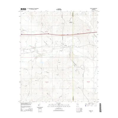
2015 Map of Chunky
USGS Topo · Published 2015About this map
The town of Chunky sits at the heart of this landscape, positioned along the winding course of the Chunky River and Chunky Cr. This 2015 survey reveals a terrain defined by its water systems and rural road networks, spanning the border of Newton and Lauderdale counties. Notable family and historical landmarks are scattered across the quadrangle, including the McGee Cem, Pine Grove Cem, and Saint Marks Cem, providing valuable points of reference for genealogists.
Find a feature on this map
64 named features on this map. Tap any name to fly to it.
Don’t see what you’re looking for? This feature index may not catch every label — zoom into the map to look around manually.
Map Details
Editions of this 2015 Chunky Map
This is the sole edition of this map. No revisions or reprints were ever made.
Other maps of this area

1953 · Meridian
USGS Topo · 1:250,000

1957 · Meridian
USGS Topo · 1:250,000

1957 · Chunky
USGS Topo · 1:62,500

1957 · Enterprise
USGS Topo · 1:62,500

1965 · Meridian
USGS Topo · 1:250,000

1966 · Hickory
USGS Topo · 1:24,000

1966 · Decatur
USGS Topo · 1:24,000

1970 · Hero
USGS Topo · 1:24,000

1982 · Meehan
USGS Topo · 1:24,000
1982 · Duffee
USGS Topo · 1:24,000