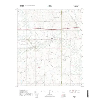
2018 Map of Chunky
USGS Topo · Published 2018About this map
The town of Chunky serves as the focal point of this east-central Mississippi landscape, situated where the Chunky Creek and Okahatta Creek converge to form the Chunky River. The topography is defined by a dense network of waterways including Tallahatta Creek and Potterchitto Creek, which snake through the timbered terrain. This survey captures a mix of rural infrastructure and community history, evidenced by numerous family-named and local roads such as Beason Rd, McGee Rd, and Hickory Fellowship Rd. Genealogists will find particular value in the documentation of local burial sites, including Saint Marks Cem, McGee Cem, and Pine Grove Cem. The presence of Parks Mill Rd suggests a legacy of local milling industry, while the Newton Co Lauderdale Co line provides a clear administrative boundary for regional research.
Find a feature on this map
59 named features on this map. Tap any name to fly to it.
Don’t see what you’re looking for? This feature index may not catch every label — zoom into the map to look around manually.
Map Details
Editions of this 2018 Chunky Map
This is the sole edition of this map. No revisions or reprints were ever made.
Other maps of this area

1953 · Meridian
USGS Topo · 1:250,000

1957 · Meridian
USGS Topo · 1:250,000

1957 · Chunky
USGS Topo · 1:62,500

1957 · Enterprise
USGS Topo · 1:62,500

1965 · Meridian
USGS Topo · 1:250,000

1966 · Hickory
USGS Topo · 1:24,000

1966 · Decatur
USGS Topo · 1:24,000

1970 · Hero
USGS Topo · 1:24,000

1982 · Meehan
USGS Topo · 1:24,000
1982 · Duffee
USGS Topo · 1:24,000