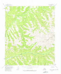
1955 Map of Circle A-3
USGS Topo · Published 1975About this map
The Middle Fork Chena River winds through this interior landscape, defining a remote region dominated by a network of drainage basins. Mapping in the mid-1950s reveals an environment shaped by early aviation and resource extraction, anchored by the Van Curlers Bar Landing Strip and a Placer Mine located south of the river. The southern portion of the quadrangle is largely occupied by the Fort Wainwright Military Reservation, while the surrounding terrain is marked by unnamed Cabins and minor landing areas. The intricate hydrology is evidenced by numerous named tributaries such as Bear Creek, California Creek, and Salmonfoot Creek, which flow through the unsurveyed and unmarked lands of the Fairbanks Meridian. This document serves as a record of the wilderness just before the 1970s revisions, showing the intersection of military boundaries and the lonely outpost infrastructure of the Alaskan bush.
Find a feature on this map
26 named features on this map. Tap any name to fly to it.
Don’t see what you’re looking for? This feature index may not catch every label — zoom into the map to look around manually.
Map Details
Editions of this 1955 Circle A-3 Map
2 editions found
Other maps of this area

1950 · Big Delta
USGS Topo · 1:250,000

1951 · Big Delta
USGS Topo · 1:250,000

1951 · Circle
USGS Topo · 1:250,000

1952 · Circle A-4
USGS Topo · 1:63,360

1952 · Circle B-4
USGS Topo · 1:63,360

1955 · Circle B-3
USGS Topo · 1:63,360

1955 · Circle A-2
USGS Topo · 1:63,360

1955 · Circle A-3
USGS Topo · 1:63,360

1955 · Circle B-2
USGS Topo · 1:63,360

1955 · Circle
USGS Topo · 1:250,000