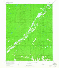
1952 Map of Circle D-3
USGS Topo · Published 1965About this map
Crazy Mountains dominate the southern portion of this interior Alaska wilderness, with the Little Crazy Mountains forming a distinct sub-range to the north. This 1950s-era landscape is defined by its complex hydrologic network, notably the winding path of Preacher Creek which meanders through the central valley. The topography was mapped using photogrammetric methods from 1951 aerial photography, revealing a land of swamps and low-relief terrain punctuated by sharp elevation gains in the southern peaks.
Find a feature on this map
5 named features on this map. Tap any name to fly to it.
Don’t see what you’re looking for? This feature index may not catch every label — zoom into the map to look around manually.
Map Details
Editions of this 1952 Circle D-3 Map
2 editions found
Other maps of this area

1951 · Fort Yukon
USGS Topo · 1:250,000

1951 · Circle
USGS Topo · 1:250,000

1952 · Circle D-4
USGS Topo · 1:63,360

1952 · Circle D-3
USGS Topo · 1:63,360

1952 · Circle D-2
USGS Topo · 1:63,360

1952 · Circle C-4
USGS Topo · 1:63,360

1955 · Circle C-3
USGS Topo · 1:63,360

1955 · Circle C-2
USGS Topo · 1:63,360

1955 · Circle
USGS Topo · 1:250,000

1956 · Fort Yukon A-2
USGS Topo · 1:63,360