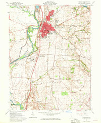
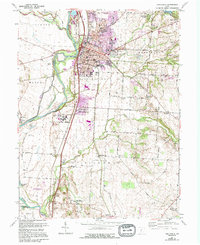
1961 Map of Circleville
USGS Topo · Published 1970About this map
The industrial and agricultural heart of Pickaway County is defined here by the confluence of the Scioto River and Big Darby Creek. The city of Circleville serves as a major hub, its grid integrated with the Norfolk and Western Railway and the Pennsylvania Railroad. Beyond the urban center, the landscape transitions into the productive Pickaway Plains, where the presence of an Indian Mound and the Logan Elm State Memorial marks the deep cultural history of the Scioto Valley.
Find a feature on this map
92 named features on this map. Tap any name to fly to it.
Don’t see what you’re looking for? This feature index may not catch every label — zoom into the map to look around manually.
Map Details
Editions of this 1961 Circleville Map
5 editions found
Other maps of this area

1906 · Chillicothe
USGS Topo · 1:62,500

1908 · Chillicothe
USGS Topo · 1:62,500

1911 · Era
USGS Topo · 1:62,500

1912 · Roxabell
USGS Topo · 1:62,500

1913 · Era
USGS Topo · 1:62,500

1914 · Roxabell
USGS Topo · 1:62,500

1914 · Circleville
USGS Topo · 1:62,500

1943 · Era
USGS Topo · 1:62,500

1943 · Circleville
USGS Topo · 1:62,500

1944 · Roxabell
USGS Topo · 1:62,500
Featured Places
- Circleville, OH
- Wayne Township, OH
- Eastmoor Subdivision, Circleville
- Washington Township, OH
- Circleville Township, OH