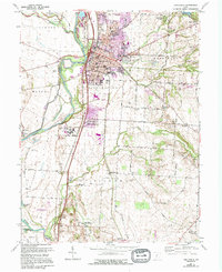
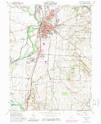
1961 Map of Circleville
USGS Topo · Published 1995About this map
Circleville sits at a historic crossroads where the Norfolk and Western and Chesapeake and Ohio railroads converge near the banks of the Scioto River. This 1961 survey, updated in the mid-1990s, documents the expansion of the city into new residential developments like Knollwood Village and Jefferson Estates. South of the city, the Pickaway Plains dominate the landscape, a region of significant archaeological and historical weight. This is evidenced by the preservation of the Logan Elm State Memorial and a noted Indian Mound near Hitler No 1 Rd.
Find a feature on this map
79 named features on this map. Tap any name to fly to it.
Don’t see what you’re looking for? This feature index may not catch every label — zoom into the map to look around manually.
Map Details
Editions of this 1961 Circleville Map
5 editions found
Other maps of this area

1906 · Chillicothe
USGS Topo · 1:62,500

1908 · Chillicothe
USGS Topo · 1:62,500

1911 · Era
USGS Topo · 1:62,500

1912 · Roxabell
USGS Topo · 1:62,500

1913 · Era
USGS Topo · 1:62,500

1914 · Roxabell
USGS Topo · 1:62,500

1914 · Circleville
USGS Topo · 1:62,500

1943 · Era
USGS Topo · 1:62,500

1943 · Circleville
USGS Topo · 1:62,500

1944 · Roxabell
USGS Topo · 1:62,500
Featured Places
- Circleville, OH
- Wayne Township, OH
- Eastmoor Subdivision, Circleville
- Washington Township, OH
- Circleville Township, OH