
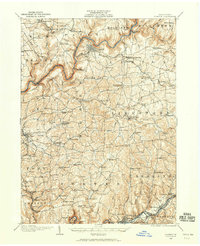
1906 Map of Clarion
USGS Topo · Published 1906About this map
The Clarion River snakes through the heart of this Western Pennsylvania landscape, serving as a corridor for the Clarion River RR and the Pittsburgh and Western RR (Narrow Gage). This early twentieth-century survey reveals a region deeply tied to resource extraction and small-scale agriculture, with the Jocelyn Mine and Keystone Mine dotting the southern reaches near Rimersburg. The density of rural institutions is striking, with nearly every ridge and valley supporting a local schoolhouse like the Burma (Five Points) School or a congregation at Concord Church.
Find a feature on this map
133 named features on this map. Tap any name to fly to it.
Don’t see what you’re looking for? This feature index may not catch every label — zoom into the map to look around manually.
Map Details
Editions of this 1906 Clarion Map
2 editions found
Other maps of this area

1900 · Kittanning
USGS Topo · 1:62,500

1901 · Rural Valley
USGS Topo · 1:62,500

1902 · Kittanning
USGS Topo · 1:62,500

1903 · Rural Valley
USGS Topo · 1:62,500

1907 · Clarion
USGS Topo · 1:62,500

1907 · Foxburg
USGS Topo · 1:62,500

1908 · Foxburg
USGS Topo · 1:62,500

1909 · Smicksburg
USGS Topo · 1:62,500

1918 · Loleta
USGS Topo · 1:62,500

1922 · Oil City
USGS Topo · 1:48,000