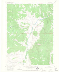
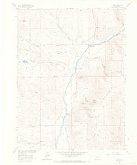
1962 Map of Clark
USGS Topo · Published 1968About this map
The Elk River corridor defines this portion of the Routt National Forest during the early 1960s, serving as the primary axis for settlement and industry. The small community of Clark and the nearby Glen Eden cluster along the valley floor, supported by a network of water management features like the Murphy Ditch and Campbell Ditch. This era shows a landscape where high-altitude resource extraction and ranching infrastructure coexist, evidenced by the Greenville Mine and a Sawmill tucked into the eastern timberline.
Find a feature on this map
42 named features on this map. Tap any name to fly to it.
Don’t see what you’re looking for? This feature index may not catch every label — zoom into the map to look around manually.
Map Details
Editions of this 1962 Clark Map
5 editions found
Other maps of this area

1911 · Hahns Peak
USGS Topo · 1:125,000

1913 · Hahns Peak
USGS Topo · 1:125,000

1923 · Pilot Knob
USGS Topo · 1:62,500

1925 · Pilot Knob
USGS Topo · 1:62,500

1954 · Craig
USGS Topo · 1:250,000

1957 · Craig
USGS Topo · 1:250,000

1958 · Craig
USGS Topo · 1:250,000

1960 · Craig
USGS Topo · 1:250,000

1962 · Craig
USGS Topo · 1:250,000
1962 · Rocky Peak
USGS Topo · 1:24,000