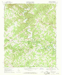
1968 Map of Claudville
USGS Topo · Published 1971About this map
The Dan River carves a winding path through this 1968 landscape, marking the transition from the Virginia Piedmont into the rising elevations of the Blue Ridge. Small agricultural and timber communities like Claudville, Meadowfield, and Carters Mill are scattered throughout the hills, connected by local routes such as Asbury Road. The map reveals a deeply rooted rural society defined by its churches and schools, including Red Bank Jr High Sch, Hatchers Chapel, and Unity Ch. A notable landmark, the Lookout Tower atop Simmons Mountain, overlooks the rugged terrain where Patrick, Surry, and Stokes counties converge at the Virginia-North Carolina state line. Further south, the presence of Big Dan Lake and Joyce Mill near the river suggests a reliance on local water power and recreation during this period of the late 1960s.
Find a feature on this map
66 named features on this map. Tap any name to fly to it.
Don’t see what you’re looking for? This feature index may not catch every label — zoom into the map to look around manually.
Map Details
Editions of this 1968 Claudville Map
3 editions found
Other maps of this area

1889 · Hillsville
USGS Topo · 1:125,000

1891 · Yadkinville
USGS Topo · 1:125,000

1892 · Hillsville
USGS Topo · 1:125,000

1893 · Yadkinville
USGS Topo · 1:125,000

1896 · Hillsville
USGS Topo · 1:125,000

1928 · Stuart
USGS Topo · 1:48,000

1931 · Stuart
USGS Topo · 1:62,500

1953 · Winston-Salem
USGS Topo · 1:250,000

1955 · Winston-Salem
USGS Topo · 1:250,000

1957 · Mount Airy
USGS Topo · 1:62,500