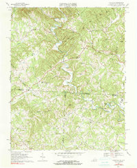
1968 Map of Claudville
USGS Topo · Published 1991About this map
Claudville serves as the central hub of this Piedmont landscape, situated just north of the winding Virginia and North Carolina state line. The Dan River carves a deep path through the terrain, flanked by significant elevations like Simmons Mountain and Mill Mtn. This late 1960s perspective reveals a rural community anchored by numerous local congregations and schools, including Clarks Creek Ch, Hatchers Chapel, and the Red Bank Jr High Sch.
Find a feature on this map
50 named features on this map. Tap any name to fly to it.
Don’t see what you’re looking for? This feature index may not catch every label — zoom into the map to look around manually.
Map Details
Editions of this 1968 Claudville Map
3 editions found
Other maps of this area

1889 · Hillsville
USGS Topo · 1:125,000

1891 · Yadkinville
USGS Topo · 1:125,000

1892 · Hillsville
USGS Topo · 1:125,000

1893 · Yadkinville
USGS Topo · 1:125,000

1896 · Hillsville
USGS Topo · 1:125,000

1928 · Stuart
USGS Topo · 1:48,000

1931 · Stuart
USGS Topo · 1:62,500

1953 · Winston-Salem
USGS Topo · 1:250,000

1955 · Winston-Salem
USGS Topo · 1:250,000

1957 · Mount Airy
USGS Topo · 1:62,500