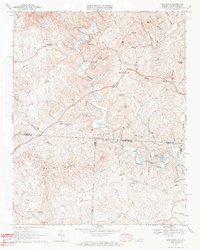
1968 Map of Claudville
USGS Topo · Published 1971About this map
Claudville and the winding course of the Dan River anchor this late-1960s study of the Virginia-North Carolina borderlands. The landscape is defined by the transition from the high ridges of Chestnut Ridge and Simmons Mountain down into the fertile creek valleys that supported rural communities like Meadowfield and Carters Mill. A series of family-named landmarks and local institutions, including Hatchers Chapel, Unity Ch, and the Red Bank Jr High Sch, reveal a social fabric built around crossroads and small-scale agriculture. The infrastructure of the era is preserved in detail, from the Lookout Tower atop the peaks to the network of timber and farm roads like Telephone Road and Christian Road. Along the southern border, the map captures the beginning of Big Dan Lake and the settlement at Asbury, reflecting the early post-war development in Patrick County.
Find a feature on this map
71 named features on this map. Tap any name to fly to it.
Don’t see what you’re looking for? This feature index may not catch every label — zoom into the map to look around manually.
Map Details
Editions of this 1968 Claudville Map
3 editions found
Other maps of this area

1889 · Hillsville
USGS Topo · 1:125,000

1891 · Yadkinville
USGS Topo · 1:125,000

1892 · Hillsville
USGS Topo · 1:125,000

1893 · Yadkinville
USGS Topo · 1:125,000

1896 · Hillsville
USGS Topo · 1:125,000

1928 · Stuart
USGS Topo · 1:48,000

1931 · Stuart
USGS Topo · 1:62,500

1953 · Winston-Salem
USGS Topo · 1:250,000

1955 · Winston-Salem
USGS Topo · 1:250,000

1957 · Mount Airy
USGS Topo · 1:62,500