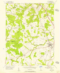
1955 Map of Clayton
USGS Topo · Published 1956About this map
Clayton serves as the primary hub on the border of New Castle and Kent County, where the Pennsylvania rail lines intersect the local landscape. The mid-century settlement pattern is defined by a dense network of named crossroads and agricultural corners, such as Grears Corners, Blodgetts Corners, and Thomas Corners. This layout suggests a resilient rural economy reliant on these localized gathering points before the full dominance of the Du Pont Parkway to the east.
Find a feature on this map
50 named features on this map. Tap any name to fly to it.
Don’t see what you’re looking for? This feature index may not catch every label — zoom into the map to look around manually.
Map Details
Editions of this 1955 Clayton Map
3 editions found
Other maps of this area

1899 · Dover
USGS Topo · 1:125,000

1900 · Cecilton
USGS Topo · 1:62,500

1905 · Barclay
USGS Topo · 1:62,500

1906 · Dover
USGS Topo · 1:125,000

1920 · Dover
USGS Topo · 1:125,000

1926 · Wyoming
USGS Topo · 1:48,000

1930 · Wyoming
USGS Topo · 1:62,500

1931 · Wyoming
USGS Topo · 1:62,500

1931 · Smyrna
USGS Topo · 1:62,500
1944 · Cecilton
USGS Topo · 1:31,680