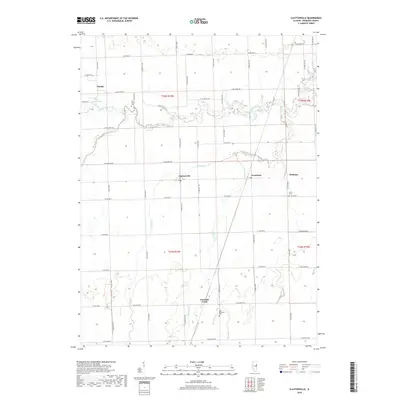
2018 Map of Claytonville
USGS Topo · Published 2018About this map
Claytonville and the surrounding Iroquois County landscape are defined by a rhythmic grid of county roads and meandering prairie waterways. In the north, the waters of Little Mud Creek and Pigeon Creek feed into Mud Creek, which snakes eastward past the Ash Grove Cem. This drainage network was essential to the agricultural development of the region, supporting small settlements like Goodwine and Hickman that served as local hubs.
Find a feature on this map
61 named features on this map. Tap any name to fly to it.
Don’t see what you’re looking for? This feature index may not catch every label — zoom into the map to look around manually.
Map Details
Editions of this 2018 Claytonville Map
This is the sole edition of this map. No revisions or reprints were ever made.
Other maps of this area

1933 · Hoopeston
USGS Topo · 1:48,000

1936 · Potomac
USGS Topo · 1:62,500

1938 · Milford
USGS Topo · 1:48,000

1938 · Hoopeston
USGS Topo · 1:62,500

1939 · Cissna Park
USGS Topo · 1:62,500

1944 · Milford
USGS Topo · 1:62,500

1949 · Cissna Park
USGS Topo · 1:62,500

1953 · Danville
USGS Topo · 1:250,000

1955 · Danville
USGS Topo · 1:250,000

1956 · Danville
USGS Topo · 1:250,000