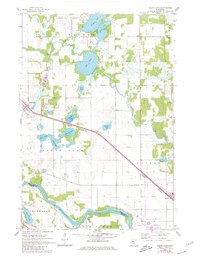
1961 Map of Clear Lake
USGS Topo · Published 1980About this map
The Mississippi River creates a natural southern boundary for this central Minnesota landscape, where the settlements of Clear Lake and Becker serve as anchors along a busy transportation corridor. The Northern Pacific and Great Northern railroads run parallel through the heart of the region, facilitating the movement of goods and people between the river valley and the interior lakes. Central to the local identity is a cluster of water bodies including Briggs Lake, Rush Lake, and Elk Lake, which support recreational sites like the Campground and the Leaders Clear Lake Airfield. The map documents the intricate drainage systems of Lilly Creek and Rice Creek, alongside smaller landmarks such as the local Cem and several gravel pits, illustrating a mid-century balance between rural agricultural life and the growing transit infrastructure of Sherburne and Wright counties.
Find a feature on this map
32 named features on this map. Tap any name to fly to it.
Don’t see what you’re looking for? This feature index may not catch every label — zoom into the map to look around manually.
Map Details
Editions of this 1961 Clear Lake Map
3 editions found
Other maps of this area

1950 · St. Cloud
USGS Topo · 1:62,500

1951 · Annandale
USGS Topo · 1:62,500

1953 · Saint Cloud
USGS Topo · 1:250,000

1953 · Stillwater
USGS Topo · 1:250,000

1955 · Stillwater
USGS Topo · 1:250,000

1957 · Saint Cloud
USGS Topo · 1:250,000

1958 · Stillwater
USGS Topo · 1:250,000

1958 · Saint Cloud
USGS Topo · 1:250,000

1961 · Clear Lake
USGS Topo · 1:24,000

1961 · Silver Creek
USGS Topo · 1:24,000