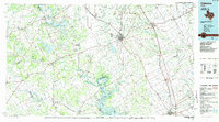
1985 Map of Cleburne
USGS Topo · Published 1985About this map
The Brazos River carves a winding path through this North Central Texas region, defined by deep horseshoe bends like Kimball Bend and De Cordova Bend. By the mid-1980s, the landscape had been significantly altered by large-scale water projects, including the Squaw Creek Reservoir and Lake Granbury, which contrast with the older river-oriented settlements. For genealogists and local historians, the map preserves the exact locations of rural landmarks like Mt Carmel Ch and Oak Hill Sch alongside the growing rail hubs of Cleburne and Alvarado. The topography is marked by distinctive elevations such as Comanche Peak and Caddo Peak, while recreation areas like Dinosaur Valley State Park near Glen Rose highlight the area's prehistoric significance. The extensive rail network, including the Atchison Topeka and Santa Fe RR, illustrates the commercial connections between these Johnson and Hood County communities.
Find a feature on this map
117 named features on this map. Tap any name to fly to it.
Don’t see what you’re looking for? This feature index may not catch every label — zoom into the map to look around manually.
Map Details
Editions of this 1985 Cleburne Map
2 editions found
Other maps of this area

1888 · Hamilton
USGS Topo · 1:125,000

1888 · Meridian
USGS Topo · 1:125,000

1889 · Granbury
USGS Topo · 1:125,000

1890 · Stephenville
USGS Topo · 1:125,000

1891 · Weatherford
USGS Topo · 1:125,000

1891 · Dallas
USGS Topo · 1:125,000

1891 · Palo Pinto
USGS Topo · 1:125,000

1891 · Cleburne
USGS Topo · 1:125,000

1892 · Waco
USGS Topo · 1:125,000

1893 · Dallas
USGS Topo · 1:125,000