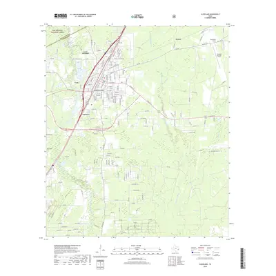
2019 Map of Cleveland
USGS Topo · Published 2019About this map
The Cleveland township and its surrounding timberlands and marshes are documented here, situated at the border of San Jacinto and Liberty counties. This region is characterized by the watershed of the East Fork San Jacinto River and numerous waterways such as Tarkington Bayou and Marsh Br. The settlement pattern reflects the influence of the Sam Houston National Forest to the northwest, while the town itself shows a dense street grid including Martin Luther King Dr and Santa Fe St. Rural life outside the center is marked by family-named landmarks and local burial grounds, including Wells Cemetery and the smaller Pin Oak Cem. Transportation and commerce are centered on the rail corridors and local airfields like Cleveland Municipal Airport and Cavok Airpark, which serve this pocket of Southeast Texas.
Find a feature on this map
161 named features on this map. Tap any name to fly to it.
Don’t see what you’re looking for? This feature index may not catch every label — zoom into the map to look around manually.
Map Details
Editions of this 2019 Cleveland Map
This is the sole edition of this map. No revisions or reprints were ever made.
Other maps of this area

1943 · Liberty
USGS Topo · 1:125,000

1954 · Beaumont
USGS Topo · 1:250,000

1955 · Rayburn
USGS Topo · 1:62,500

1955 · Liberty
USGS Topo · 1:62,500

1957 · Beaumont
USGS Topo · 1:250,000

1958 · Fostoria
USGS Topo · 1:24,000

1958 · Cleveland
USGS Topo · 1:24,000

1958 · Westcott
USGS Topo · 1:24,000

1958 · Bear Creek
USGS Topo · 1:24,000

1959 · Plum Grove
USGS Topo · 1:24,000