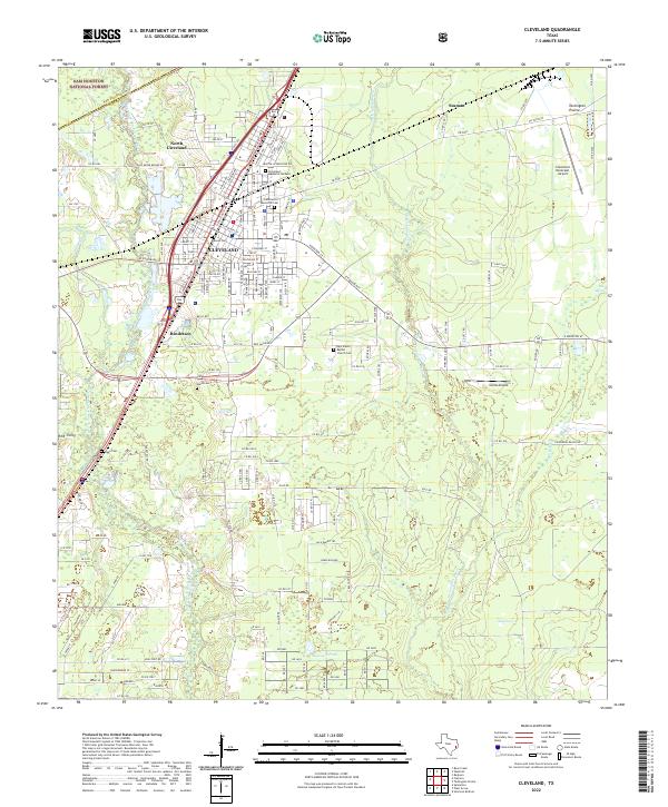
2022 Map of Cleveland
USGS Topo · Published 2022About this map
The East Fork San Jacinto River defines the western edge of this corridor through Liberty and San Jacinto Counties, where the city of Cleveland serves as a primary regional hub. Modern infrastructure like the BNSF Railway and Cleveland Municipal Airport exists alongside older rural markers, including the New Salem Baptist Church and historical family burial grounds like Wells Cem and Riggs Cem. This 2022 survey documents the transition from the wooded periphery of the Sam Houston National Forest to the open flats of The Marsh.
Find a feature on this map
90 named features on this map. Tap any name to fly to it.
Don’t see what you’re looking for? This feature index may not catch every label — zoom into the map to look around manually.
Map Details
Editions of this 2022 Cleveland Map
This is the sole edition of this map. No revisions or reprints were ever made.
Other maps of this area

1943 · Liberty
USGS Topo · 1:125,000

1954 · Beaumont
USGS Topo · 1:250,000

1955 · Rayburn
USGS Topo · 1:62,500

1955 · Liberty
USGS Topo · 1:62,500

1957 · Beaumont
USGS Topo · 1:250,000

1958 · Fostoria
USGS Topo · 1:24,000

1958 · Cleveland
USGS Topo · 1:24,000

1958 · Westcott
USGS Topo · 1:24,000

1958 · Bear Creek
USGS Topo · 1:24,000

1959 · Plum Grove
USGS Topo · 1:24,000