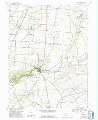
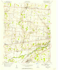
1968 Map of Clifton
USGS Topo · Published 1992About this map
Clifton Gorge and the sharp descent of the Little Miami River define the central landscape of this western Ohio region during the late 1960s. The village of Clifton sits at the precipice of this dramatic waterway, which is flanked by John Bryan State Park and marked by the Orton Memorial Monument. The map captures the agricultural and residential transition between the rural settlements of Hustead and Pitchin and the expanding infrastructure near the Springfield Municipal Airport.
Find a feature on this map
48 named features on this map. Tap any name to fly to it.
Don’t see what you’re looking for? This feature index may not catch every label — zoom into the map to look around manually.
Map Details
Editions of this 1968 Clifton Map
3 editions found
Other maps of this area

1904 · Springfield
USGS Topo · 1:62,500

1906 · Springfield
USGS Topo · 1:62,500

1907 · South Charleston
USGS Topo · 1:62,500

1916 · Octa
USGS Topo · 1:62,500

1917 · Xenia
USGS Topo · 1:62,500

1944 · Octa
USGS Topo · 1:62,500

1947 · Columbus
USGS Topo · 1:250,000

1954 · Clifton
USGS Topo · 1:24,000
1955 · Springfield
USGS Topo · 1:24,000
1955 · Donnelsville
USGS Topo · 1:24,000