
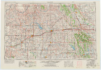
1955 Map of Clinton
USGS Topo · Published 1964About this map
The Canadian River and Washita River systems carve through western Oklahoma, defining a landscape of agricultural settlements and military infrastructure during the mid-1950s. A prominent feature of this era is the Clinton-Sherman AFB, situated south of Foss Reservoir. The map documents a dense network of rural infrastructure, including numerous country schools like Meridian School and Highway School, and churches such as Vicksburg Church and Pleasant Valley Church.
Find a feature on this map
118 named features on this map. Tap any name to fly to it.
Don’t see what you’re looking for? This feature index may not catch every label — zoom into the map to look around manually.
Map Details
Editions of this 1955 Clinton Map
3 editions found
Other maps of this area

1892 · Kingfisher
USGS Topo · 1:125,000

1893 · Fort Reno
USGS Topo · 1:62,500

1893 · Buggy Creek
USGS Topo · 1:62,500

1893 · Hennessey
USGS Topo · 1:62,500

1893 · Minco
USGS Topo · 1:62,500

1893 · Loyal
USGS Topo · 1:62,500

1893 · Ames
USGS Topo · 1:62,500

1895 · Kingfisher
USGS Topo · 1:125,000

1902 · Rush Springs
USGS Topo · 1:125,000

1904 · Chickasha
USGS Topo · 1:125,000