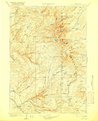
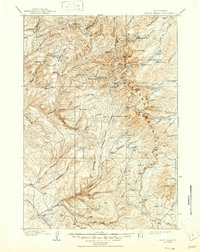
1901 Map of Cloud Peak
USGS Topo · Published 1917About this map
Big Horn Mountains dominate this 1901 survey, which follows the rugged high-country watershed during the early years of the Big Horn National Forest. Centered on the towering granite of Cloud Pk and the sharp profile of Black Tooth, the map details a landscape of glacial cirques and alpine basins. The topography is defined by deep incisions like Tensleep Canyon and Burke Canyon, which drain westward toward the No Wood Creek valley.
Find a feature on this map
64 named features on this map. Tap any name to fly to it.
Don’t see what you’re looking for? This feature index may not catch every label — zoom into the map to look around manually.
Map Details
Editions of this 1901 Cloud Peak Map
7 editions found

Other maps of this area

1895 · Dayton
USGS Topo · 1:125,000

1898 · Bald Mountain
USGS Topo · 1:125,000

1899 · Cloud peak
USGS Topo · 1:125,000

1900 · Fort McKinney
USGS Topo · 1:125,000

1901 · Cloud Peak
USGS Topo · 1:125,000

1901 · Dayton
USGS Topo · 1:125,000

1901 · Bald Mountain
USGS Topo · 1:125,000

1903 · Fort McKinney
USGS Topo · 1:125,000

1909 · Sheridan
USGS Topo · 1:125,000

1911 · Sheridan
USGS Topo · 1:125,000