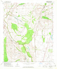
1964 Map of Coahoma
USGS Topo · Published 1965About this map
The Illinois Central railroad corridor anchors the eastern half of this Mississippi Delta landscape, connecting the town of Coahoma to Rudyard and southern points like Clover Hill. The terrain is defined by the complex hydrology of the Sunflower River and its accompanying sloughs, including Buzzards Roost Brake and Hamson Brake. These low-lying wetlands are interspersed with established agricultural operations such as the Prairie Plantation and King & Anderson Ranch, while the presence of Indian Mounds near Barkley Bayou suggests a much older layer of human habitation. Local community life in the mid-1960s centered around scattered rural institutions, from Coahoma Jr College to the Pilgrim Rest Ch, reflecting a deeply rooted plantation-based economy transitioning toward a more modern era of aviation at Fletcher Field.
Find a feature on this map
46 named features on this map. Tap any name to fly to it.
Don’t see what you’re looking for? This feature index may not catch every label — zoom into the map to look around manually.
Map Details
Editions of this 1964 Coahoma Map
2 editions found
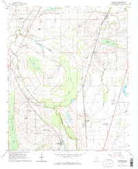
Other maps of this area

1908 · Lula
USGS Topo · 1:24,000

1908 · Coahoma
USGS Topo · 1:24,000

1908 · Moon Lake
USGS Topo · 1:24,000

1908 · Jonestown
USGS Topo · 1:24,000

1910 · Coahoma
USGS Topo · 1:31,680

1910 · Jonestown
USGS Topo · 1:31,680

1912 · Moon Lake
USGS Topo · 1:31,680

1912 · Lula
USGS Topo · 1:31,680

1932 · Tutwiler
USGS Topo · 1:48,000

1932 · Marks
USGS Topo · 1:48,000