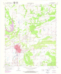
1957 Map of Coalgate
USGS Topo · Published 1979About this map
The coal-rich landscape of southeastern Oklahoma is documented here during a period of transition in the late 1950s. Coalgate serves as the primary hub, surrounded by smaller coal-country settlements like Cottonwood and Phillips. The industrial footprint of the region is clearly visible through the Phillips Strip Mine and numbered shafts such as Sandmann Mine No 2 and Mine No 21, which highlight the area's mining heritage. These sites are interspersed among winding waterways like Muddy Boggy Creek and its many tributaries.
Find a feature on this map
35 named features on this map. Tap any name to fly to it.
Don’t see what you’re looking for? This feature index may not catch every label — zoom into the map to look around manually.
Map Details
Editions of this 1957 Coalgate Map
3 editions found
Other maps of this area

1896 · Coalgate
USGS Topo · 1:125,000

1899 · Coalgate
USGS Topo · 1:125,000

1899 · Atoka
USGS Topo · 1:125,000

1900 · Atoka
USGS Topo · 1:125,000

1900 · Coalgate
USGS Topo · 1:125,000

1956 · Stringtown
USGS Topo · 1:24,000

1957 · Coalgate
USGS Topo · 1:24,000

1957 · Lehigh
USGS Topo · 1:24,000

1957 · Coalgate SE
USGS Topo · 1:24,000

1957 · Centrahoma
USGS Topo · 1:24,000