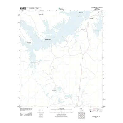
2012 Map of Cocodrie Lake
USGS Topo · Published 2012About this map
Cocodrie Lake dominates this central Louisiana landscape, where the labyrinthine waterways of Bayou Cocodrie, Caney Bayou, and Horse Br meet. The map reveals a transition between the dense aquatic environment and the structured settlements to the east. Small communities like Clearwater and Meridian are situated along the primary north-south corridor, while boat landings such as Clubhouse Landing, Bennett Bay Landing, and Hester Landing provide access to the complex shoreline. Genealogy and local history are preserved in the locations of Oak Grove Cemetery, Duplissey Cemetery, and McCormack Cemetery. Land features like Peterson Island and Island Gap Island emerge from the lake, while the presence of the Meridian Lookout Tower points toward the importance of forest management in this timber-rich region of Evangeline Parish.
Find a feature on this map
22 named features on this map. Tap any name to fly to it.
Don’t see what you’re looking for? This feature index may not catch every label — zoom into the map to look around manually.
Map Details
Editions of this 2012 Cocodrie Lake Map
This is the sole edition of this map. No revisions or reprints were ever made.
Other maps of this area

1935 · Beaver
USGS Topo · 1:31,680

1935 · Turkey Creek
USGS Topo · 1:62,500

1935 · Lecompte
USGS Topo · 1:62,500

1942 · Oakdale
USGS Topo · 1:62,500

1949 · Glenmora
USGS Topo · 1:31,680

1949 · Turkey Creek
USGS Topo · 1:62,500

1952 · Lake Charles
USGS Topo · 1:250,000

1953 · Alexandria
USGS Topo · 1:250,000
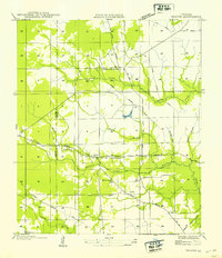
1954 · Beaver
USGS Topo · 1:31,680

1954 · Lake Charles
USGS Topo · 1:250,000