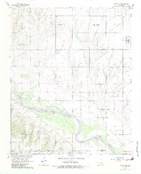
1968 Map of Cogar NE
USGS Topo · Published 1983About this map
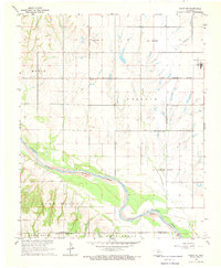
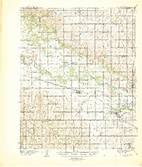
The Canadian River meanders across the landscape south of the El Reno Corporate Boundary in this late 1960s study. The terrain is defined by large regional divisions including Maple Prairie, East Walnut, and Lone Rock, reflecting the open agricultural character of Canadian and Grady counties. This period captures a transition in local land use, where the expansive prairie landscape is punctuated by the small settlement at Heaston and aviation activity at Mustang Field on the eastern edge of the survey area.
Find a feature on this map
13 named features on this map. Tap any name to fly to it.
Don’t see what you’re looking for? This feature index may not catch every label — zoom into the map to look around manually.
Map Details
Editions of this 1968 Cogar NE Map
2 editions found
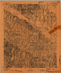
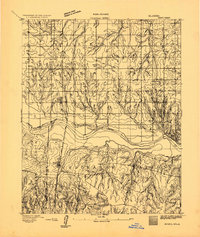
Other maps of this area

1892 · Kingfisher
USGS Topo · 1:125,000

1893 · Fort Reno
USGS Topo · 1:62,500
1893 · Buggy Creek
USGS Topo · 1:62,500
1893 · Minco
USGS Topo · 1:62,500

1895 · Kingfisher
USGS Topo · 1:125,000

1904 · Chickasha
USGS Topo · 1:125,000
1941 · Fort Reno
USGS Topo · 1:62,500

1942 · Fort Reno
USGS Topo · 1:62,500

1949 · Fort Reno
USGS Topo · 1:62,500

1954 · Oklahoma City
USGS Topo · 1:250,000