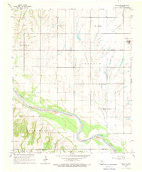
1968 Map of Cogar NE
USGS Topo · Published 1969About this map
The Canadian River meanders through this portion of Oklahoma, defining a landscape where the El Reno Corporate Boundary and Union City Corporate Boundary meet the agricultural expanse of Maple Prairie. This 1968 field-checked survey reveals the rural layout of the region before significant suburban expansion, highlighting the proximity of the Canadian and Caddo and Canadian and Grady county lines. Small-scale local landmarks like Heaston Ch and Buena Vista Cem provide essential anchor points for family historians and researchers interested in the mid-century settlement patterns of the area. The presence of Mustang Field at the eastern edge suggests the intersection of local aviation and the traditional farming economies of East Walnut and Washington.
Find a feature on this map
13 named features on this map. Tap any name to fly to it.
Don’t see what you’re looking for? This feature index may not catch every label — zoom into the map to look around manually.
Map Details
Editions of this 1968 Cogar NE Map
2 editions found
Other maps of this area

1892 · Kingfisher
USGS Topo · 1:125,000

1893 · Fort Reno
USGS Topo · 1:62,500

1893 · Buggy Creek
USGS Topo · 1:62,500

1893 · Minco
USGS Topo · 1:62,500

1895 · Kingfisher
USGS Topo · 1:125,000

1904 · Chickasha
USGS Topo · 1:125,000

1941 · Fort Reno
USGS Topo · 1:62,500

1942 · Fort Reno
USGS Topo · 1:62,500

1949 · Fort Reno
USGS Topo · 1:62,500

1954 · Oklahoma City
USGS Topo · 1:250,000