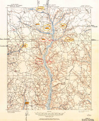
1909 Map of Coharie
USGS Topo · Published 1950About this map
Great Coharie Creek and its complex network of tributaries, such as Little Coharie Creek, define this rural portion of Sampson County during the early twentieth century. The landscape is characterized by its numerous millponds and marshy bottomlands, including Blackmans Mills, Newman Millpond, and Turlington Millpond, which were central to the local agrarian economy and water-powered industries of the era.
Find a feature on this map
64 named features on this map. Tap any name to fly to it.
Don’t see what you’re looking for? This feature index may not catch every label — zoom into the map to look around manually.
Map Details
Editions of this 1909 Coharie Map
3 editions found
Other maps of this area

1906 · Four Oaks
USGS Topo · 1:48,000

1908 · Four Oaks
USGS Topo · 1:62,500

1909 · Coharie
USGS Topo · 1:62,500

1953 · Florence
USGS Topo · 1:250,000

1953 · Raleigh
USGS Topo · 1:250,000

1954 · Florence
USGS Topo · 1:250,000

1954 · Raleigh
USGS Topo · 1:250,000

1959 · Roseboro
USGS Topo · 1:62,500

1959 · Garland
USGS Topo · 1:62,500

1962 · Rose Hill
USGS Topo · 1:62,500