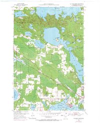
1953 Map of Cohasset West
USGS Topo · Published 1971About this map
Leech Lake Indian Reservation boundaries define the western edge of this Itasca County landscape, where the waters of Deer Lake and Bass Lake dominate the northern terrain. The village of Cohasset sits in the southeast corner near the Mississippi River, serving as a hub where the Burlington Northern railroad and a major Pipeline corridor intersect the local infrastructure. The map reveals a post-war transition in recreation and industry, featuring the Pincherry Landing Strip and various namesake islands like Battleship Island and Hog Island. Genealogists and local historians can trace the specific water levels of the era, from the deep waters of The Narrows to the smaller basins of Warba Lake and Little Drum Lake. Several Gravel Pits indicate local resource extraction, while the intricate system of brooks, including Bass Brook and Stevens Brook, illustrates the complex drainage of this lake-studded region during the early 1950s.
Find a feature on this map
49 named features on this map. Tap any name to fly to it.
Don’t see what you’re looking for? This feature index may not catch every label — zoom into the map to look around manually.
Map Details
Editions of this 1953 Cohasset West Map
3 editions found
Other maps of this area

1953 · Cohasset East
USGS Topo · 1:24,000

1953 · Siseebakwet Lake
USGS Topo · 1:24,000

1953 · Cohasset West
USGS Topo · 1:24,000

1953 · Grand Rapids
USGS Topo · 1:24,000

1954 · Hibbing
USGS Topo · 1:250,000

1957 · Hibbing
USGS Topo · 1:250,000

1958 · Hibbing
USGS Topo · 1:250,000

1964 · Hibbing
USGS Topo · 1:250,000

1970 · Deer River NE
USGS Topo · 1:24,000

1970 · Wabana Lake
USGS Topo · 1:24,000