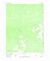
1956 Map of Coleen A-1
USGS Topo · Published 1973About this map
The United States Canada international border defines the eastern edge of this territory, where the topography was documented through aerial photography in the mid-1950s. The landscape is dominated by the westward flow of the Salmon Trout River and the northern reaches of the Campbell River. These waterways carve through high terrain marked by prominent survey points such as VABM Smith and Arch. Published by the Geological Survey with data from the International Boundary Commission, the map illustrates a wilderness area entirely devoid of roads or trails. This remote corridor along the Alaska Yukon line represents a segment of the northern interior where the natural drainage patterns of the rivers were the primary geographical markers before any modern infrastructure reached this section of the frontier.
Find a feature on this map
6 named features on this map. Tap any name to fly to it.
Don’t see what you’re looking for? This feature index may not catch every label — zoom into the map to look around manually.
Map Details
Editions of this 1956 Coleen A-1 Map
2 editions found
Other maps of this area

1951 · Black River
USGS Topo · 1:250,000

1951 · Coleen
USGS Topo · 1:250,000

1956 · Coleen
USGS Topo · 1:250,000

1956 · Coleen B-2
USGS Topo · 1:63,360
1956 · Coleen B-1
USGS Topo · 1:63,360

1956 · Coleen A-1
USGS Topo · 1:63,360

1956 · Black River D-2
USGS Topo · 1:63,360
1956 · Black River D-1
USGS Topo · 1:63,360

1956 · Coleen A-2
USGS Topo · 1:63,360

1956 · Black River
USGS Topo · 1:250,000