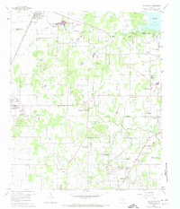
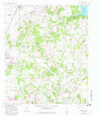
1959 Map of Colleyville
USGS Topo · Published 1974About this map
The northern reaches of Tarrant County and southern Denton County are shown here during a transitional period of suburbanization, with the 1959 base data updated by 1970s revisions. The landscape is defined by the winding course of Big Bear Creek and Little Bear Creek, which provide drainage for the emerging residential areas of Colleyville and Southlake. Cultural landmarks such as the Lonesome Dove Ch and White Chapel reflect the rural community foundations, while the proximity of Grapevine Lake at the northeast corner signals the area's development into a regional recreational hub. Transportation is anchored by the Texas and Pacific and St Louis Southwestern railroads, which bypass the older road networks like Carroll Road and School Road. Genealogists will find significant value in the documentation of several local burial grounds, including the Medlin Cem, Oddfellows Cem, and Bourland Cem.
Find a feature on this map
51 named features on this map. Tap any name to fly to it.
Don’t see what you’re looking for? This feature index may not catch every label — zoom into the map to look around manually.
Map Details
Editions of this 1959 Colleyville Map
5 editions found
Other maps of this area

1894 · Fort Worth
USGS Topo · 1:125,000

1931 · Grapevine
USGS Topo · 1:62,500

1954 · Dallas
USGS Topo · 1:250,000

1954 · Sherman
USGS Topo · 1:250,000
1955 · Haltom City
USGS Topo · 1:24,000
1955 · Keller
USGS Topo · 1:24,000

1955 · Haltom City
USGS Topo · 1:62,500

1958 · Dallas
USGS Topo · 1:250,000

1958 · Sherman
USGS Topo · 1:250,000
1959 · Euless
USGS Topo · 1:24,000