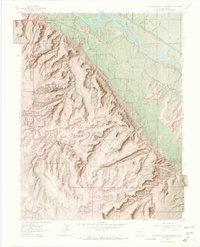
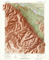
1962 Map of Colorado National Monument
USGS Topo · Published 1965About this map
Colorado National Monument dominates this landscape, showcasing the dramatic transition from the high desert plateau of Black Ridge down to the Colorado River valley. This 1962 field-checked survey highlights the intricate system of monoliths and canyons, including Independence Monument and Monument Canyon, which had already become established landmarks for visitors. The infrastructure of the park is well-defined, featuring the winding Rim Rock Drive and the historic Serpents Trail, alongside the West Entrance and East Entrance facilities.
Find a feature on this map
65 named features on this map. Tap any name to fly to it.
Don’t see what you’re looking for? This feature index may not catch every label — zoom into the map to look around manually.
Map Details
Editions of this 1962 Colorado National Monument Map
6 editions found

Other maps of this area

1934 · Colorado National Monument
USGS Topo · 1:24,000

1956 · Moab
USGS Topo · 1:250,000

1956 · Grand Junction
USGS Topo · 1:250,000

1959 · Grand Junction
USGS Topo · 1:250,000

1959 · Moab
USGS Topo · 1:250,000

1960 · Moab
USGS Topo · 1:250,000

1960 · Grand Junction
USGS Topo · 1:250,000

1962 · Moab
USGS Topo · 1:250,000

1962 · Grand Junction
USGS Topo · 1:250,000

1962 · Fruita
USGS Topo · 1:24,000