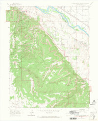
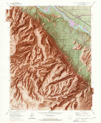
1962 Map of Colorado National Monument
USGS Topo · Published 1967About this map
Independence Monument and the spire-studded canyons of the Colorado National Monument dominate this 1962 topographic survey. The high desert landscape is defined by its verticality, featuring dramatic overlooks such as Cold Shivers Point and Artists Point, and unique formations like the Kissing Couple and Balanced Rock. Below the red-rock cliffs, the northern portion of the map shows a stark transition to the irrigated agriculture of the Grand Valley, where the South Highline Canal and Second Lift Canal feed the growing community of Redlands.
Find a feature on this map
67 named features on this map. Tap any name to fly to it.
Don’t see what you’re looking for? This feature index may not catch every label — zoom into the map to look around manually.
Map Details
Editions of this 1962 Colorado National Monument Map
6 editions found

Other maps of this area

1934 · Colorado National Monument
USGS Topo · 1:24,000

1956 · Moab
USGS Topo · 1:250,000

1956 · Grand Junction
USGS Topo · 1:250,000

1959 · Grand Junction
USGS Topo · 1:250,000

1959 · Moab
USGS Topo · 1:250,000

1960 · Moab
USGS Topo · 1:250,000

1960 · Grand Junction
USGS Topo · 1:250,000

1962 · Moab
USGS Topo · 1:250,000

1962 · Grand Junction
USGS Topo · 1:250,000

1962 · Fruita
USGS Topo · 1:24,000