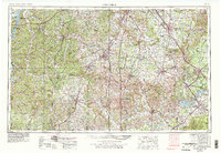
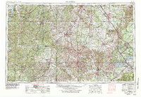
1956 Map of Columbia
USGS Topo · Published 1979About this map
The Duck River meanders across this 1950s landscape, serving as a primary drainage for Middle Tennessee through Columbia and Shelbyville. This survey, revised in the late 1970s, captures the region's mid-century transition as hydroelectric and infrastructure projects matured. Large-scale water features like Kentucky Lake on the western edge and Tims Ford Lake to the southeast underscore the hydrological management of the Elk River and other tributaries. In the east, the Arnold Engineering Development Center stands near Tullahoma, representing the era's significant military and aerospace footprint.
Find a feature on this map
61 named features on this map. Tap any name to fly to it.
Don’t see what you’re looking for? This feature index may not catch every label — zoom into the map to look around manually.
Map Details
Editions of this 1956 Columbia Map
6 editions found

Other maps of this area

1886 · Stevenson
USGS Topo · 1:125,000

1888 · Scottsboro
USGS Topo · 1:125,000

1888 · Huntsville
USGS Topo · 1:125,000

1892 · Huntsville
USGS Topo · 1:125,000

1892 · Scottsboro
USGS Topo · 1:125,000

1892 · Stevenson
USGS Topo · 1:125,000

1893 · Mc Minnville
USGS Topo · 1:125,000

1895 · Stevenson
USGS Topo · 1:125,000

1895 · Mc Minnville
USGS Topo · 1:125,000

1895 · Sewanee
USGS Topo · 1:125,000