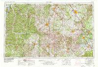
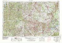
1956 Map of Columbia
USGS Topo · Published 1979About this map
Duck River and Buffalo River drainage basins define the central character of this Middle Tennessee survey, which captures the region during a period of significant hydroelectric and military development. Regional centers like Columbia and Murfreesboro are connected by a mature network of railroads, including the Louisville & Nashville RR and the Nashville, Chattanooga & St. Louis Ry. The landscape is marked by the presence of large federal and state installations, from the Arnold Engineering Development Center near Tullahoma to the Smyrna Air Force Base. To the west, the Tennessee River forms Kentucky Lake, while inland reservoirs like Tims Ford Lake and Normandy Lake illustrate the mid-century transformation of the local waterways. Preservation of the region's diverse history is evident at the Stone River National Battlefield and various state parks like Old Stone Fort State Park.
Find a feature on this map
134 named features on this map. Tap any name to fly to it.
Don’t see what you’re looking for? This feature index may not catch every label — zoom into the map to look around manually.
Map Details
Editions of this 1956 Columbia Map
6 editions found

Other maps of this area

1886 · Stevenson
USGS Topo · 1:125,000

1888 · Scottsboro
USGS Topo · 1:125,000

1888 · Huntsville
USGS Topo · 1:125,000

1892 · Huntsville
USGS Topo · 1:125,000

1892 · Scottsboro
USGS Topo · 1:125,000

1892 · Stevenson
USGS Topo · 1:125,000

1893 · Mc Minnville
USGS Topo · 1:125,000

1895 · Stevenson
USGS Topo · 1:125,000

1895 · Mc Minnville
USGS Topo · 1:125,000

1895 · Sewanee
USGS Topo · 1:125,000