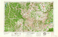
1956 Map of Columbia
USGS Topo · Published 1960About this map
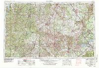
The Duck River and Buffalo River systems carve through the heart of Middle Tennessee on this mid-century survey, which reveals a region defined by its diverse terrain and burgeoning infrastructure. To the east, the sprawling facilities of the Arnold Engineering Development Center stand adjacent to the recently decommissioned Camp Forrest (abandoned), signaling the era's shift from wartime mobilization to Cold War aerospace research. The landscape transitions from the high ground of Short Mountain and the distinct topography of The Barrens to the fertile river valleys supporting established centers like Murfreesboro, Columbia, and Franklin. Significant water management and conservation efforts are evident in the presence of Kentucky Lake and the Tennessee National Wildlife Refuge. The map also captures the extensive rail network of the period, including the Nashville Chattanooga & St Louis Ry and the Tennessee Central RR, which linked these agricultural and industrial hubs to the wider Tennessee Valley economy.
Find a feature on this map
42 named features on this map. Tap any name to fly to it.
Don’t see what you’re looking for? This feature index may not catch every label — zoom into the map to look around manually.
Map Details
Editions of this 1956 Columbia Map
6 editions found

Other maps of this area

1886 · Stevenson
USGS Topo · 1:125,000

1888 · Scottsboro
USGS Topo · 1:125,000

1888 · Huntsville
USGS Topo · 1:125,000

1892 · Huntsville
USGS Topo · 1:125,000

1892 · Scottsboro
USGS Topo · 1:125,000

1892 · Stevenson
USGS Topo · 1:125,000

1893 · Mc Minnville
USGS Topo · 1:125,000

1895 · Stevenson
USGS Topo · 1:125,000

1895 · Mc Minnville
USGS Topo · 1:125,000

1895 · Sewanee
USGS Topo · 1:125,000