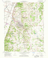
1955 Map of Columbia
USGS Topo · Published 1969About this map
Sugarloaf Heights and the Sugar Loaf bluffs dominate the landscape east of the Mississippi floodplains, where the Gulf Mobile and Ohio and Missouri Pacific railroads converge. This mid-century survey captures Columbia as it expands along the ridge, supported by vital transport hubs like Millstadt Junction and the Columbia J B Airfield. The map reveals a high density of family and community landmarks, particularly across the southern reaches where New Hanover sits near the Zoar Ch and New Hanover Station. Genealogists will find an exceptional number of burial sites, including the Shoemaker Cem, McConkey Cem, and Palmer Cem. Industrial footprints are visible at the northern Quarry and an intriguing Experimental Underground Gas Storage facility, reflecting the area's geological utility during the Cold War era.
Find a feature on this map
50 named features on this map. Tap any name to fly to it.
Don’t see what you’re looking for? This feature index may not catch every label — zoom into the map to look around manually.
Map Details
Editions of this 1955 Columbia Map
3 editions found
Other maps of this area

1888 · St. Louis
USGS Topo · 1:62,500

1910 · Waterloo
USGS Topo · 1:62,500

1912 · Kimmswick
USGS Topo · 1:62,500

1913 · Waterloo
USGS Topo · 1:62,500

1916 · Kimmswick
USGS Topo · 1:62,500

1931 · French Village
USGS Topo · 1:24,000

1933 · Jefferson Barracks
USGS Topo · 1:24,000

1933 · Cahokia
USGS Topo · 1:24,000

1934 · Cahokia
USGS Topo · 1:24,000

1935 · French Village
USGS Topo · 1:24,000