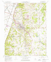
1955 Map of Columbia
USGS Topo · Published 1975About this map
The American Bottoms floodplain meets the rising bluffs of the Sugarloaf and Millstadt uplands in this mid-century view of the St. Louis metropolitan fringe. The town of Columbia serves as a central hub, situated where the bluffs drop toward the lowlands of Carr Creek and Little Carr Creek. The landscape is a dense network of multi-generational family heritage, evidenced by numerous small burial grounds such as Lark Cem, Kleinschmidt Cem, and McConkey Cem that dot the countryside.
Find a feature on this map
60 named features on this map. Tap any name to fly to it.
Don’t see what you’re looking for? This feature index may not catch every label — zoom into the map to look around manually.
Map Details
Editions of this 1955 Columbia Map
3 editions found
Other maps of this area

1888 · St. Louis
USGS Topo · 1:62,500

1910 · Waterloo
USGS Topo · 1:62,500

1912 · Kimmswick
USGS Topo · 1:62,500

1913 · Waterloo
USGS Topo · 1:62,500

1916 · Kimmswick
USGS Topo · 1:62,500

1931 · French Village
USGS Topo · 1:24,000

1933 · Jefferson Barracks
USGS Topo · 1:24,000

1933 · Cahokia
USGS Topo · 1:24,000

1934 · Cahokia
USGS Topo · 1:24,000

1935 · French Village
USGS Topo · 1:24,000