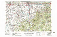
1967 Map of Columbus
USGS Topo · Published 1977About this map
The Scioto River valley anchors this mid-century landscape, tracing a path through the state capital at Columbus down to Chillicothe. During this era, the region saw significant institutional and military expansion, evidenced by the sprawling grounds of Ohio State University and strategic installations like Lockbourne AFB and Clinton Co AFB. To the west, the London Correctional Institution stands near the headwaters of Darby Creek, while the eastern hills are heavily forested, containing vast tracts of the Wayne National Forest and Zaleski State Forest.
Find a feature on this map
107 named features on this map. Tap any name to fly to it.
Don’t see what you’re looking for? This feature index may not catch every label — zoom into the map to look around manually.
Map Details
Editions of this 1967 Columbus Map
2 editions found

Other maps of this area

1901 · Dublin
USGS Topo · 1:62,500

1902 · Westerville
USGS Topo · 1:62,500

1903 · Dublin
USGS Topo · 1:62,500

1903 · Athens
USGS Topo · 1:62,500

1904 · Westerville
USGS Topo · 1:62,500

1904 · Springfield
USGS Topo · 1:62,500

1904 · Zaleski
USGS Topo · 1:62,500

1904 · Dayton
USGS Topo · 1:62,500

1904 · Chesterhill
USGS Topo · 1:62,500

1905 · Athens
USGS Topo · 1:62,500