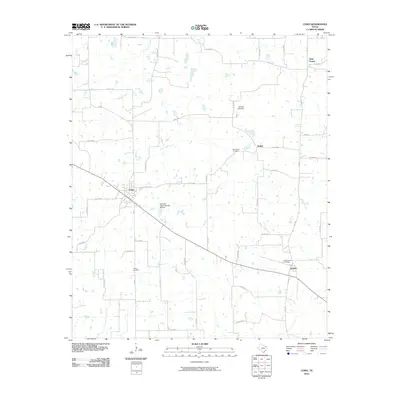
2010 Map of Como
USGS Topo · Published 2010About this map
The town of Como serves as a central hub for this portion of Hopkins County, where the local road network converges near the railroad corridor. Moving eastward, the landscape transitions toward Pickton and the smaller community of Bethel, illustrating the persistent small-town settlement patterns of East Texas. The map records several vital historical sites for genealogists, including Woodland Cemetery, Coffee Cemetery, and New Pickton Cemetery, which are tucked away among the rural county roads. Drainage is dominated by the winding paths of Richland Creek and East Caney Creek, with several water control structures such as Gamblin Lake Dam influencing the local topography. This 2010 survey provides a clear view of the area just before significant modern shifts in rural infrastructure, preserving the locations of outlying settlements like Pine Forest and its associated road network.
Find a feature on this map
42 named features on this map. Tap any name to fly to it.
Don’t see what you’re looking for? This feature index may not catch every label — zoom into the map to look around manually.
Map Details
Editions of this 2010 Como Map
This is the sole edition of this map. No revisions or reprints were ever made.
Other maps of this area

1953 · Texarkana
USGS Topo · 1:250,000

1956 · Texarkana
USGS Topo · 1:250,000

1956 · Tyler
USGS Topo · 1:250,000

1959 · Yantis
USGS Topo · 1:24,000

1959 · Alba
USGS Topo · 1:62,500

1960 · Winnsboro
USGS Topo · 1:24,000

1960 · Pleasant Grove
USGS Topo · 1:24,000

1964 · Saltillo
USGS Topo · 1:24,000

1964 · Como
USGS Topo · 1:24,000

1964 · Purley
USGS Topo · 1:24,000