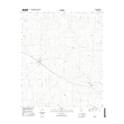
2016 Map of Como
USGS Topo · Published 2016About this map
Como and Pickton anchor this corner of East Texas, where the landscape is defined by the headwaters of several prominent creeks. The terrain is marked by the winding courses of Richland Cr, Morris Cr, and E Caney Cr, which feed into localized catchments such as Gamblin Lake. The rural character of the area is emphasized by its sparse development and the preservation of legacy landmarks. Genealogists and local historians will find value in the documentation of several burial grounds, including Woodland Cem, Coffee Cem, and the New Pickton Cem. A modern addition to this largely agricultural landscape is the Flying B Airport, located south of the main road corridor. The map provides a detailed look at the dense network of county roads, such as Co RD 2333 and Co RD 2415, that weave through the rolling creek valleys and timbered patches of Hopkins County.
Find a feature on this map
67 named features on this map. Tap any name to fly to it.
Don’t see what you’re looking for? This feature index may not catch every label — zoom into the map to look around manually.
Map Details
Editions of this 2016 Como Map
This is the sole edition of this map. No revisions or reprints were ever made.
Other maps of this area

1953 · Texarkana
USGS Topo · 1:250,000

1956 · Texarkana
USGS Topo · 1:250,000

1956 · Tyler
USGS Topo · 1:250,000

1959 · Yantis
USGS Topo · 1:24,000

1959 · Alba
USGS Topo · 1:62,500

1960 · Winnsboro
USGS Topo · 1:24,000

1960 · Pleasant Grove
USGS Topo · 1:24,000

1964 · Saltillo
USGS Topo · 1:24,000

1964 · Como
USGS Topo · 1:24,000

1964 · Purley
USGS Topo · 1:24,000