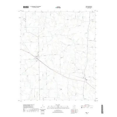
2019 Map of Como
USGS Topo · Published 2019About this map
Como and Pickton anchor this corner of Hopkins County, showing a landscape defined by small-scale cattle ranching and scattered rural homesteads. The terrain is partitioned by a network of county roads, such as Co RD 2332 and Co RD 2346, which navigate the gentle drainages of Richland Creek, Morris Creek, and E Caney Creek. For genealogists, the map provides precise locations for several local burial grounds, including Woodland Cemetery and the New Pickton Cemetery located near the eastern edge of the survey. The presence of the Flying B Airport reflects the continued integration of private aviation into the region's ranching and transit infrastructure. This survey captures the enduring rural character of East Texas, where the local economy remains tied to the land and its seasonal creek beds even as modern infrastructure like the Flying B Airport serves the community.
Find a feature on this map
69 named features on this map. Tap any name to fly to it.
Don’t see what you’re looking for? This feature index may not catch every label — zoom into the map to look around manually.
Map Details
Editions of this 2019 Como Map
This is the sole edition of this map. No revisions or reprints were ever made.
Other maps of this area

1953 · Texarkana
USGS Topo · 1:250,000

1956 · Texarkana
USGS Topo · 1:250,000

1956 · Tyler
USGS Topo · 1:250,000

1959 · Yantis
USGS Topo · 1:24,000

1959 · Alba
USGS Topo · 1:62,500

1960 · Winnsboro
USGS Topo · 1:24,000

1960 · Pleasant Grove
USGS Topo · 1:24,000

1964 · Saltillo
USGS Topo · 1:24,000

1964 · Como
USGS Topo · 1:24,000

1964 · Purley
USGS Topo · 1:24,000