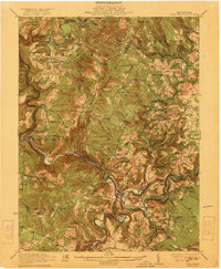
1922 Map of Confluence
USGS Topo · Published 1922About this map
The confluence of the Casselman River and Youghiogheny River anchors this 1922 survey of Somerset and Fayette Counties. This mountainous region of Pennsylvania shows a landscape deeply defined by its drainage and early industrial access, where the Baltimore and Ohio RR and Western Maryland RR trace the winding river valleys. Notable river infrastructure includes the Shoofly Tunnel and Brooks Tunnel, which allowed rail lines to pierce the ridge lines while the National Pike traversed the southern hills through Somerfield. Local industry is evidenced by the Mary Ann Mine and Baldwin Mine near Humbert. The social fabric of these rural townships is densely mapped, featuring numerous one-room schoolhouses like Three Maples School and Sugarloaf School, alongside spiritual centers such as Old Bethel Church and Wesley Chapel.
Find a feature on this map
95 named features on this map. Tap any name to fly to it.
Don’t see what you’re looking for? This feature index may not catch every label — zoom into the map to look around manually.
Map Details
Editions of this 1922 Confluence Map
3 editions found
Other maps of this area

1899 · Grantsville
USGS Topo · 1:62,500

1900 · Accident
USGS Topo · 1:62,500

1900 · Uniontown
USGS Topo · 1:62,500

1902 · Connellsville
USGS Topo · 1:62,500

1904 · Bruceton
USGS Topo · 1:62,500

1904 · Grantsville
USGS Topo · 1:62,500

1913 · Somerset
USGS Topo · 1:62,500

1915 · Somerset
USGS Topo · 1:62,500

1921 · Meyersdale
USGS Topo · 1:62,500

1922 · Confluence
USGS Topo · 1:62,500