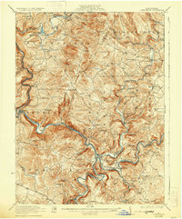
1922 Map of Confluence
USGS Topo · Published 1930About this map
Youghiogheny River and Casselman River converge at the town of Confluence, carving deep valleys through the high ridges of Laurel Hill. Surveyed just after the Great War, the landscape is defined by the heavy infrastructure of the Baltimore and Ohio Railroad and the Western Maryland Railroad, which trace the riverbanks to navigate the steep elevation changes. Near Somerfield, the historic National Pike crosses the water, providing a primary east-west artery through Fayette and Somerset counties.
Find a feature on this map
108 named features on this map. Tap any name to fly to it.
Don’t see what you’re looking for? This feature index may not catch every label — zoom into the map to look around manually.
Map Details
Editions of this 1922 Confluence Map
3 editions found
Other maps of this area

1899 · Grantsville
USGS Topo · 1:62,500

1900 · Accident
USGS Topo · 1:62,500

1900 · Uniontown
USGS Topo · 1:62,500

1902 · Connellsville
USGS Topo · 1:62,500

1904 · Bruceton
USGS Topo · 1:62,500

1904 · Grantsville
USGS Topo · 1:62,500

1913 · Somerset
USGS Topo · 1:62,500

1915 · Somerset
USGS Topo · 1:62,500

1921 · Meyersdale
USGS Topo · 1:62,500

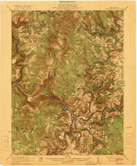
1922 · Confluence
USGS Topo · 1:62,500