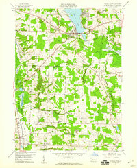
1959 Map of Conneaut Lake
USGS Topo · Published 1960About this map
Conneaut Lake serves as the focal point of this Crawford County landscape, where the borough of the same name developed along its western shore as a primary regional hub. By the late 1950s, the area supported a mix of tourism and local industry, evidenced by the presence of a Drive-in Theater and the Conneaut Lake Airport. The transportation network is particularly dense here, featuring the Bessemer and Lake Erie RR and the Erie RR, alongside the historic route of the Lake Erie and Ohio River Canal. To the southeast, the U S Military Reservation Keystone Ordnance Works occupies a significant tract, contrasting with the recreational and agricultural lands nearby. Local genealogy is well-preserved through numerous family-named burial grounds like McMichael Cem and Mushrush Cem, as well as small rural communities such as Atlantic and Shermansville.
Find a feature on this map
50 named features on this map. Tap any name to fly to it.
Don’t see what you’re looking for? This feature index may not catch every label — zoom into the map to look around manually.
Map Details
Editions of this 1959 Conneaut Lake Map
4 editions found
Other maps of this area

1906 · Linesville
USGS Topo · 1:62,500

1908 · Shenango
USGS Topo · 1:62,500

1908 · Linesville
USGS Topo · 1:62,500

1911 · Stoneboro
USGS Topo · 1:62,500

1913 · Stoneboro
USGS Topo · 1:62,500

1923 · Meadville
USGS Topo · 1:62,500

1925 · Meadville
USGS Topo · 1:62,500

1943 · Meadville
USGS Topo · 1:62,500

1943 · Stoneboro
USGS Topo · 1:62,500

1950 · Cleveland
USGS Topo · 1:250,000
Featured Places
- Conneaut Lake, PA
- West Fallowfield Township, PA
- West Vernon, PA
- East Fallowfield Township, PA
- Adamsville, PA