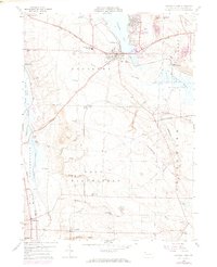
1959 Map of Conneaut Lake
USGS Topo · Published 1972About this map
Conneaut Lake serves as the focal point for this landscape in northwestern Pennsylvania, surrounded by a complex network of glacial geography and industrial history. The transition from the lake's open water to the Pymatuning Swamp and the Conneaut Outlet demonstrates the unique hydrologic character of Sadsbury and East Fallowfield townships. Significant transport infrastructure defines the region, including the Bessemer and Lake Erie and Erie-Lackawanna railroads, which parallel historical routes like the Lake Erie and Ohio River Canal.
Find a feature on this map
59 named features on this map. Tap any name to fly to it.
Don’t see what you’re looking for? This feature index may not catch every label — zoom into the map to look around manually.
Map Details
Editions of this 1959 Conneaut Lake Map
4 editions found
Other maps of this area

1906 · Linesville
USGS Topo · 1:62,500

1908 · Shenango
USGS Topo · 1:62,500

1908 · Linesville
USGS Topo · 1:62,500

1911 · Stoneboro
USGS Topo · 1:62,500

1913 · Stoneboro
USGS Topo · 1:62,500

1923 · Meadville
USGS Topo · 1:62,500

1925 · Meadville
USGS Topo · 1:62,500

1943 · Meadville
USGS Topo · 1:62,500

1943 · Stoneboro
USGS Topo · 1:62,500

1950 · Cleveland
USGS Topo · 1:250,000
Featured Places
- Conneaut Lake, PA
- West Fallowfield Township, PA
- West Vernon, PA
- East Fallowfield Township, PA
- Adamsville, PA