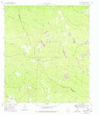
1959 Map of Conroe NE
USGS Topo · Published 1978About this map
Sam Houston National Forest dominates this landscape along the border of San Jacinto and Montgomery counties, reflecting a period of significant land management and timber conservation. The terrain is defined by a dense network of waterways, most notably the meandering Peach Creek and the West Fork San Jacinto River, which carve through the wooded bottomlands. Remote rural life is evidenced by small community centers like Salem Ch and China Grove Ch, situated along early improved and unimproved roads.
Find a feature on this map
20 named features on this map. Tap any name to fly to it.
Don’t see what you’re looking for? This feature index may not catch every label — zoom into the map to look around manually.
Map Details
Editions of this 1959 Conroe NE Map
3 editions found
Other maps of this area

1954 · Beaumont
USGS Topo · 1:250,000

1957 · Beaumont
USGS Topo · 1:250,000

1958 · Conroe
USGS Topo · 1:24,000

1958 · Fostoria
USGS Topo · 1:24,000

1958 · Bear Creek
USGS Topo · 1:24,000

1959 · Cut and Shoot
USGS Topo · 1:24,000

1959 · Conroe NE
USGS Topo · 1:24,000

1960 · Willis
USGS Topo · 1:24,000

1960 · Maynard
USGS Topo · 1:24,000

1960 · New Waverly
USGS Topo · 1:24,000