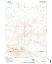
1958 Map of Continental Peak
USGS Topo · Published 1995About this map
The Emigrant Trail and the Oregon South Pass Stage Road dominate the northern terrain of this quadrangle, tracing the historic movement of travelers through the high sagebrush and sloughs of central Wyoming. This landscape is defined by its drainage patterns and prominent landmarks, centered on the heights of Continental Peak near the boundary of Fremont Co Sweetwater Co. The map captures the arid character of the region through numerous named drainages, including Meadow Creek and Oregon Slough. To the south, the intricate erosional features of the Honeycomb Buttes stand above Red Creek and the North Fork Bear Creek. This 1950s record provides a clear look at the transcontinental paths that once funneled thousands of pioneers westward, long after the height of the wagon era but before modern development altered these historic corridors.
Find a feature on this map
13 named features on this map. Tap any name to fly to it.
Don’t see what you’re looking for? This feature index may not catch every label — zoom into the map to look around manually.
Map Details
Editions of this 1958 Continental Peak Map
4 editions found
Other maps of this area

1953 · Radium Springs
USGS Topo · 1:24,000

1953 · Atlantic City
USGS Topo · 1:24,000

1953 · South Pass City
USGS Topo · 1:24,000

1955 · Lander
USGS Topo · 1:250,000

1958 · Lander
USGS Topo · 1:250,000

1958 · Circle Bar Lake
USGS Topo · 1:24,000

1958 · Freighter Gap
USGS Topo · 1:62,500

1958 · The Pinnacles
USGS Topo · 1:62,500

1958 · Dickie Springs
USGS Topo · 1:24,000

1958 · Continental Peak
USGS Topo · 1:24,000