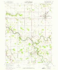
1960 Map of Continental
USGS Topo · Published 1973About this map
The Auglaize River and Blanchard River converge in this western Ohio landscape, creating a fertile river valley defined by early transport and industry. The winding course of the rivers dictated the placement of small agricultural and industrial centers like Dupont and Cloverdale, while the Norfolk and Western railroad established Continental as a significant junction. Notable for local historians, the map preserves the alignment of the Miami and Erie Canal (Abandoned) in Washington Township, which once served as a primary trade artery before the rail era took over.
Find a feature on this map
36 named features on this map. Tap any name to fly to it.
Don’t see what you’re looking for? This feature index may not catch every label — zoom into the map to look around manually.
Map Details
Editions of this 1960 Continental Map
4 editions found
Other maps of this area

1906 · Columbus Grove
USGS Topo · 1:62,500

1908 · Columbus Grove
USGS Topo · 1:62,500

1908 · Ottawa
USGS Topo · 1:62,500

1909 · Continental
USGS Topo · 1:62,500

1911 · Delphos
USGS Topo · 1:62,500

1944 · Delphos
USGS Topo · 1:62,500

1953 · Fort Wayne
USGS Topo · 1:250,000

1953 · Muncie
USGS Topo · 1:250,000

1956 · Muncie
USGS Topo · 1:250,000

1956 · Fort Wayne
USGS Topo · 1:250,000