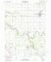
1960 Map of Continental
USGS Topo · Published 1990About this map
The Auglaize River and Blanchard River converge in this western Ohio landscape, creating a complex drainage network that includes the Little Auglaize River and South Powell Creek. The village of Continental serves as the regional hub, situated at the crossing of the Norfolk and Western and an Old Railroad Grade. This transport-dependent history is further evidenced by the Miami and Erie Canal (Abandoned) in the southwest corner near Mandale.
Find a feature on this map
35 named features on this map. Tap any name to fly to it.
Don’t see what you’re looking for? This feature index may not catch every label — zoom into the map to look around manually.
Map Details
Editions of this 1960 Continental Map
4 editions found
Other maps of this area

1906 · Columbus Grove
USGS Topo · 1:62,500

1908 · Columbus Grove
USGS Topo · 1:62,500

1908 · Ottawa
USGS Topo · 1:62,500

1909 · Continental
USGS Topo · 1:62,500

1911 · Delphos
USGS Topo · 1:62,500

1944 · Delphos
USGS Topo · 1:62,500

1953 · Fort Wayne
USGS Topo · 1:250,000

1953 · Muncie
USGS Topo · 1:250,000

1956 · Muncie
USGS Topo · 1:250,000

1956 · Fort Wayne
USGS Topo · 1:250,000