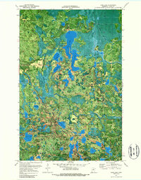
1970 Map of Coon Lake
USGS Topo · Published 1988About this map
Scenic State Park and the surrounding timberlands of the George Washington State Forest define this landscape in the northern lake country. Published from 1969 aerial photography and 1970 field checks, this orthophotomap provides a rare overhead view of the dense forest cover and complex hydrology of the region. The central Coon Lake is flanked by several smaller named basins including Sandwich Lake, Cedar Lake, and the distinctly shaped Lake of Isles.
Find a feature on this map
37 named features on this map. Tap any name to fly to it.
Don’t see what you’re looking for? This feature index may not catch every label — zoom into the map to look around manually.
Map Details
Editions of this 1970 Coon Lake Map
2 editions found
Other maps of this area

1919 · Release
USGS Topo · 1:62,500

1919 · Marcell
USGS Topo · 1:62,500

1943 · Release
USGS Topo · 1:62,500

1954 · Hibbing
USGS Topo · 1:250,000

1957 · Hibbing
USGS Topo · 1:250,000

1958 · Hibbing
USGS Topo · 1:250,000

1964 · Hibbing
USGS Topo · 1:250,000

1970 · Clubhouse Lake
USGS Topo · 1:24,000

1970 · Coon Lake
USGS Topo · 1:24,000
1970 · Anderson Lake
USGS Topo · 1:24,000